Sheffield Maps and Orientation
(Sheffield, South Yorkshire, England, UK)
The city of Sheffield lies in the county of South Yorkshire, on the western side of the Peak District National Park and also the Pennines. Also close to Chesterfield, Norton and Rotherham, Sheffield is a large and spreading city, with many residential suburbs.
Ranked in the top ten of England's biggest cities, Sheffield has a population exceeding half a million, and locals are often known as 'Sheffielders. The city is close to the M1, which lies to the north-east and links Barnsley and Wakefield to the north, and Sutton in Ashfield and Mansfield to the south. Much of the city's overall surrounding landscape is fairly hilly and surprisingly green, with more than two million individual trees in this area.
Maps and Orientation of the City
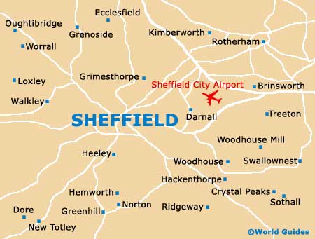
Within the city of Sheffield there are actually five different rivers. These are the Don, Loxley, Porter, Rivelin and Sheaf rivers.
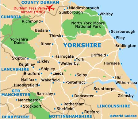
Sheffield is close to many prominent cities and towns. The following list shows the main locations, together with relevant direction, distance in both miles and kilometres, and approximate journey time.
- Chesterfield - 26 km / 16 miles (25 minutes, south)
- Doncaster - 35 km / 22 miles (30 minutes, north-east)
- Leeds - 64 km / 40 miles (45 minutes, north)
- Macclesfield - 64 km / 40 miles (one hour, south-west)
- Manchester - 82 km / 51 miles (one hour and 5 minutes, west)
- Mansfield - 48 km / 30 miles (36 minutes, south-east)
- Norton - 130 km / 81 miles (one hour and 20 minutes, south)
- Nottingham - 71 km / 44 miles (55 minutes, south-east)
- Oldham - 84 km / 52 miles (one hour and 5 minutes, north-west)
- Queensbury - 82 km / 51 miles (one hour, north-west)
- Stockport - 80 km / 50 miles (one hour, west)
Map of the United Kingdom

Map of Yorkshire
Map of South Yorkshire

Map of Sheffield